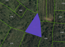
Land Agricultural land in Vinča and Topola (village), municipality of Topola
Basic data
| Code | 2056 |
| Type | Land |
| Region | Central Serbia |
| Address | Vinča |
| Town | Topola |
| Area | 33.631,00 m2 |
| Purpose of the property | Sell |
| Sales method | Owned Real Estate |
Agricultural land, nine cadastral parcels located in the territory of the municipality of Topola, the village of Vinča in the Šumadija district on the route of Prokop, Trmcak, Livada, Konavrlje and Kamenica. They are registered as 5th and 4th class fields, 3rd class orchard, 3rd class vineyard. The total land area is 33,631m2
Do you need more information?
Dušan Krejović will be in charge of the property and will see to your needs and work to answer all of your questions.
Dušan Krejović
Asset Manager +381 60 349 69 27 +381 60 349 69 27Information that you have provided, will be used exclusively for the purpose of business communication. Learn more about in our privacy policy.


